Revolutionizing Property Tax Administration with GIS
Our GeoProperty Mapping solutions empower urban local bodies and municipal corporations with accurate, up-to-date spatial property databases for enhanced tax assessment and revenue collection. We bridge the gap between physical properties and digital records through precision mapping.
Parcel-Level Accuracy
Sub-meter precision property boundary mappingData Integration
Seamless connection with existing tax databasesKey Features
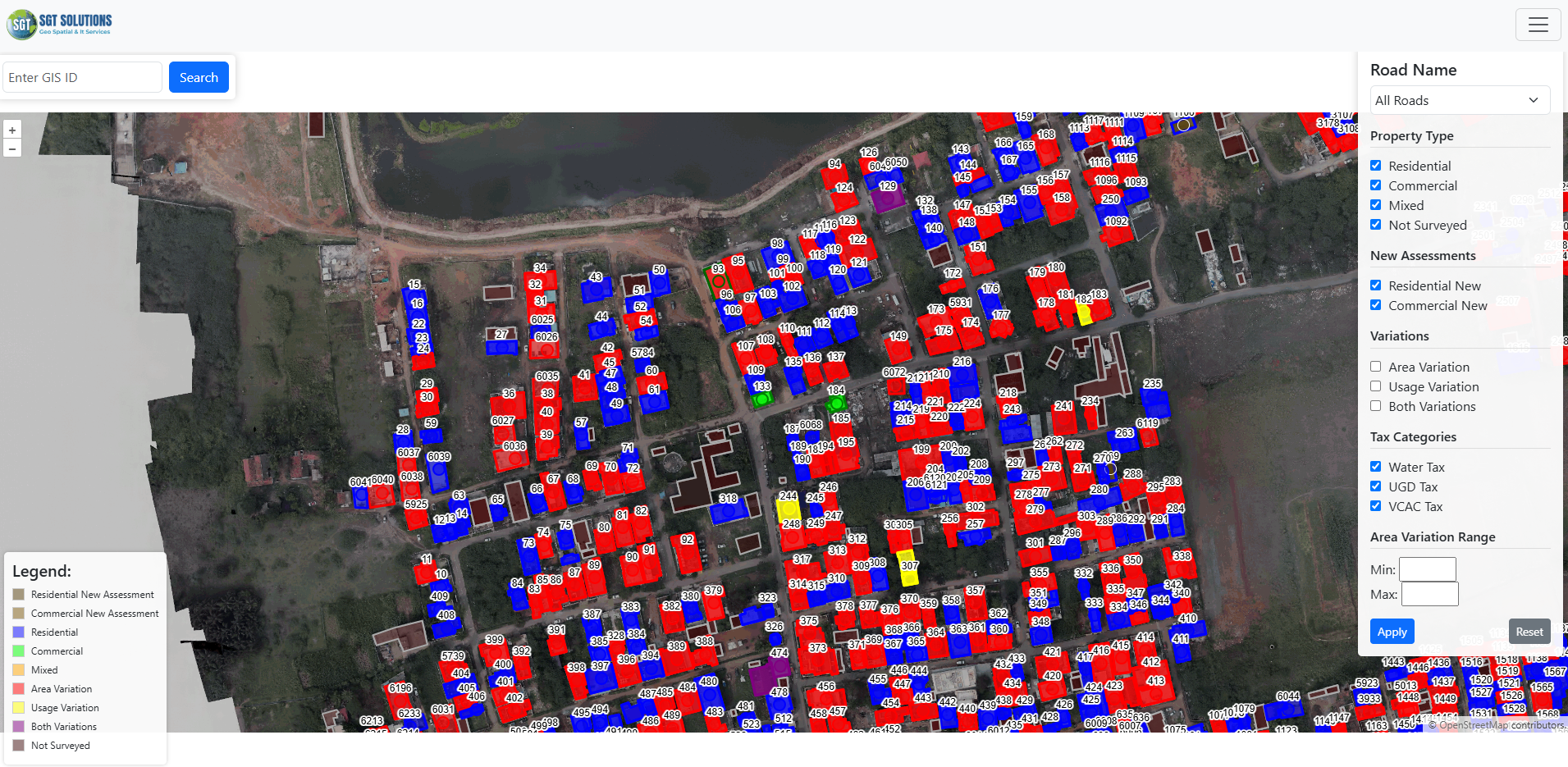
Digital Property Atlas
Comprehensive spatial database of all taxable properties with unique GIS IDs
Tax Assessment Tools
Built-in calculators for automated tax computation based on zoning and property attributes
Change Detection
Automated identification of new constructions and property modifications
Dispute Resolution
Visual documentation system for property tax appeals and verifications
Implementation Methodology
High-Resolution Imagery Processing
Creation of orthorectified base maps using drone/UAV imagery or high-res satellite data as foundation for property mapping.
Ground Truthing & Verification
GPS-enabled mobile surveys to capture property boundaries, attributes, and photographs with real-time quality checks.
System Interfacing
Linking spatial property records with existing tax databases and ULB management systems.
Tax Administrator Dashboard
Custom web GIS interface for tax assessment, monitoring, and reporting with role-based access.
Training & Handholding
Comprehensive training programs for municipal staff on system operation and maintenance.
Service Details
Mapping Standards
Compliant with NSDI guidelines and municipal governance frameworks
Attribute Data Captured
- Property boundaries
- Construction details
- Ownership records
- Usage classification
- Photographic documentation
Integration Capabilities
- Municipal financial systems
- Citizen grievance portals
- Building permission systems
- Utility management platforms
Deliverables
Geo-referenced property maps, attribute database, web portal, mobile apps, and training materials
Request Assessment
Discover how GeoProperty Mapping can increase your municipal revenue.
Get Revenue Impact Analysis

